Total Length: 24.4 Miles
Hiking/Running: Yes
Bicycling: Yes
Equestrian: No
Motorized Vehicles: No
Dog Friendly?: Yes, with leash
Description
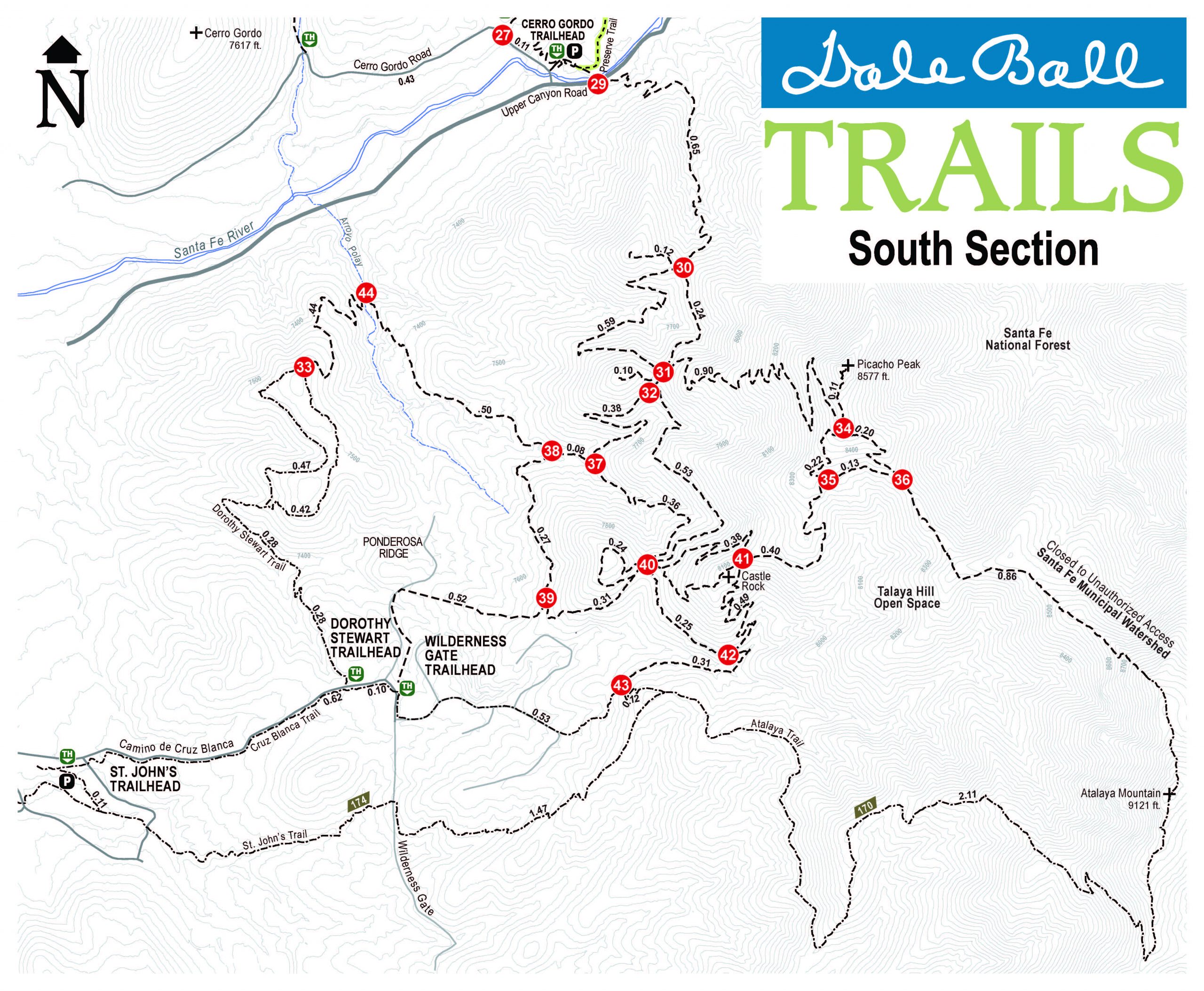
The Dale Ball Trail system is a nearly 25-mile network of natural-surface trails for hikers and bicyclists in the foothills of the Sangre de Cristo Mountains. Located a short distance from downtown Santa Fe, it is the quickest way to get from the city into the mountains. It offers great opportunities for beginners and advanced hikers alike, along with amazing views of both the surrounding wilderness and back towards the city. Trail users can navigate the trail system through trailhead maps and a system of numbered junctions, each with a local orientation map and arrow plaques indicating how to get to a next given junction, as well as connections to surrounding trails, including the La Piedra, Little Tesuque, Santa Fe Canyon Preserve, Dorothy Stewart, and Atalaya Trails.
History:
As the name would suggest, the trail system is named after Dale Ball, who was instrumental in the conception, design and construction of the trails. The City of Santa Fe, Santa Fe County and private landowners contributed key parcels of land, while contributions for the construction came from an anonymous donor and the McCune Foundation, along with a large amount of public support. For the construction itself, Dale enlisted the help of Mike Wirtz, a retired Forest Service trail specialist. The advanced way-finding sign system was made with the design help of Bill Field and updated, refurbished, and expanded in 2016 by trail volunteers working with the Santa Fe Conservation Trust.
PDF files of Junction Maps:
Most of Dale Ball Trails is managed by the City of Santa Fe, with maintenance coordinated by SFCT under our agreement with the City. The southeasternmost section, adjoining Santa Fe National Forest and including Picacho Peak and Talaya Hill Open Space, is managed by Santa Fe County.
 Access:
Dale Ball Trails can be accessed off of Hyde Park Rd., Cerro Gordo Rd., Upper Canyon Rd., and Camino Cruz Blanca. The “Sierra del Norte” Trailhead, also known as “the Corral,” offers the most moderate terrain, in the north and central parts of the trails, off of Hyde Park Road, where it intersects Sierra del Norte and Cerros Colorados. The “Cerro Gordo Trailhead” at the intersection of Upper Canyon Road and Cerro Gordo provides access to the central and the steeper south sections of the trails as well as the nature trail in the Santa Fe Canyon Preserve. Parking can also be found at St. John’s Trailhead, Dorothy Stewart Trailhead, and Wilderness Gate Trailhead on Camino Cruz Blanca, which is the closest parking to access Santa Fe National Forest’s Atalaya Trail.
The maps above are those that appear on the new junction signs that SFCT installed with trail volunteers in Fall of 2016, produced with support of the City of Santa Fe Parks and Recreation Dept. and the Trails Alliance of Santa Fe.
The most recent full map of Dale Ball Trails is available within the City of Santa Fe’s Santa Fe Foothill Trails Map 2015.
For additional information and resources, visit the Santa Fe City website here.


